


Dairy free coffee cake muffins and an airstrip in the middle of the forest
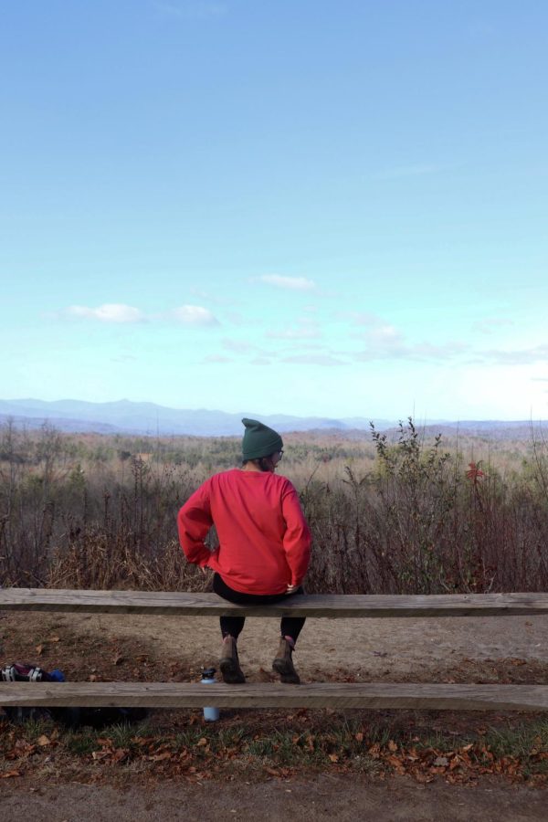
Sitting on the fence admiring the mountain views.
November 19, 2022
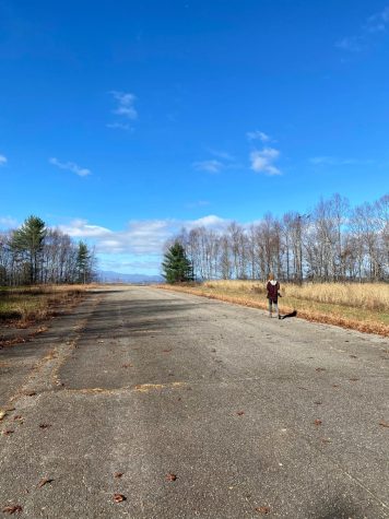
The airstrip we were hiking to seemed out of place, like it wandered there and landed far from home. How often do you stumble upon a huge piece of asphalt lying in the middle of the biggest state forest in North Carolina?
Turns out, this 2,800 feet long and 40 foot wide airstrip is more than full of its own unique history.
Ben Cart owned and constructed the airstrip in the late 1970s, utilizing it for his summer camps, one for boys and one for girls.
In the 1980s, Cart sold the property to DuPont Corp., but around the ‘90s, they gave it to Sterling Diagnostic Imaging, who used it several times for aviation purposes.
However, in 1996 a drunk driver sped across the runway, diving off of the end. He survived the crash but illegal drugs were found in his vehicle, causing concerns to circulate that drug traffickers were using the runway.
Due to this incident, Sterling asked the Federal Aviation Administration to remove the airstrip from their approved list in 1997. Sterling even went as far as to paint white X’s at the ends of the airstrip in hopes of preventing its use.
In 2000, the state bought the property, allowing the airstrip to be used for training exercises for the U.S. Air Force Pilots, North Carolina Helicopter and Aquatic Rescue Team and North Carolina Forest Service pilots. It also serves as a hub for regional medevac helicopters to transport patients.
All of that to say, possibly the coolest thing about this airstrip, in my opinion, occurred in 2011 when another place in North Carolina became a Hunger Games set location. A helicopter flew beside the airstrip, using the images of the passing forests to become what Katniss and Peeta see when they are traveling through District 12 to the capitol.
I hiked here before, accidentally stumbling upon it last year with my husband, Caleb Sonntag. We hiked around High Falls and Lake Julia, making our way to Bridal Veil Falls. On our way back, we saw a little trail to our right and followed it, ending up at the airstrip. It was a glorious discovery and I remember saying, “I have got to bring Auburn here.”
So here we are. My sister Auburn Bailey and I almost a year later at the airstrip.
For us, a hike is almost always preceded by stopping at a local coffee shop. Where does most of my money go, you might be wondering? If you’re thinking of coffee and gas for hiking trips, then you are absolutely correct.
The coffee shop of choice this time was Cup and Saucer in downtown Brevard. Different kinds of mirrors decorate one wall, while chairs and tables line the other. A long table takes up the middle floor space while leaving room for customers to approach the counter.
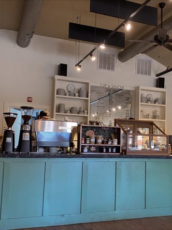
The menu is behind the counter, written beautifully on a mirror surrounded by shelves holding plates, cups and saucers.
I already had two cups of coffee so I was planning on a cup of water and praying they had some kind of pastry I could eat. I was diagnosed with a small tumor on my pituitary gland last year, whose symptoms are triggered by eating gluten. I was also diagnosed with an extreme dairy sensitivity that keeps me from putting cheese on my tacos, cream cheese on my bagels and just about everything else you can imagine.
When I looked in the pastry case and saw “coffee cake muffins: gluten and dairy free”, I got so excited.
“Are these actually dairy free?” I asked the barista.
“Yes, gluten and dairy free,” he said, reassuring me.
I immediately ordered one with a cup of water, giving him my many thanks. The muffins were amazing and Auburn can report the coffee was just as good.
“It’s the perfect combination of sweet and coffee,” she said, describing her iced caramel latte.
From Cup and Saucer we headed the 22 minutes to Fawn Lake parking lot, where we decided to access the trail from. There are a few different ways you can reach Airstrip trail, depending on how long of a hike you want, if you want to see the lakes or if you just want a pretty straight shot.
While this area is popular among hikers, it’s also very popular among mountain bikers, which we saw a lot of.
We started our hike by double checking the map. We hike to Fawn Lake to go swim and paddleboard all the time in the summer, so I knew the trail but I had never hiked to Airstrip trail from here.
Toward Fawn Lake we headed, passing up the two trails veering to the left along the way. The first is Mine Mountain, the second one a loop trail around the back side of the lake. We decided to stop at Fawn Lake and walk out on the dock.
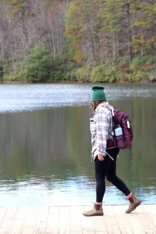
“Can you believe we swim in this?” Auburn asked, shivering at the thought. The lake looks quite eerie and dark when it’s not bustling with people on paddleboards, kids jumping off the dock and dogs chasing sticks in the summertime.
We then continued down the gravel trail to our right, one I have always wondered where it leads. It’s a beautiful trail, decorated by fallen leaves and blue skies peeking through the forest canopy. About half a mile in, you take a slight right onto Conservation Road.
“What in the world is this?” Auburn asked as we discovered what we didn’t know yet was the other end of the airstrip. There were dump trucks to our right and a huge barn/warehouse with a parking lot full of Forest Service Trucks to our left.
At first, I thought we might have come the wrong way because I didn’t recognize anything. Then I saw the trail sign that read “Airstrip Trail” and a wooden sign on the building that read “THE SUMMIT ELEV. 2800’”.
Each end still has the white X’s requested by Sterling, although they are beginning to fade.
We began to walk down the airstrip, which comes out to be around half a mile long. The other end greets you with a beautiful mountain view and a nice flat, grassy spot to enjoy it.
Auburn and I sat there for probably an hour, munching on apples and energy balls I made a few days ago. I think this end of the airstrip must be the one the drunk driver drove off because it’s the one with the steepest edge. How he survived it, I don’t understand.
We met many mountain bikers, stopping to give directions to one and talk to a couple who were enamored with the group of turkeys making their way across the asphalt.
“Did y’all see the turkeys? I told them it was time to run and hide while they still had time,” the woman said, laughing.
Auburn and I laughed along with her, wished them a good rest of their ride and headed back down the trail. This time, we decided to stay on Conservation Road instead of heading back toward Fawn Lake. It wasn’t any longer than our hike to the airstrip, in fact it might have been shorter. We ended up taking a right up Reasonover Road, landing us right there at the parking lot.
Call me biased but nothing compares to the feeling of going on a good hike and feeling so satisfied when you get back to your car. I always refill my water bottle and change out of my hiking shoes into my driving shoes, my good old trusty Birkenstocks.
Earlier this fall when I had just finished hiking Sam Knob, another hiker saw me changing my shoes and said “hiking shoes and driving shoes. That’s the way to do it.” I would call that a hiker’s equivalent of “if you know, you know”.
I keep thinking about how much knowing the history of this hike made it so much more real to me. I can just imagine the kids at Ben Cart’s summer camps and the forest service pilots doing their training there. Let’s not forget Katniss and Peeta, I will now forever think of them when I’m hiking Airstrip Trail.