


October in the Great “Spooky” Mountains
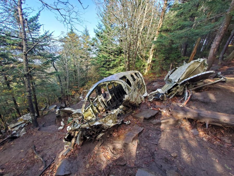
The plane crash from the trail.
October marks the beginning of spooky season for many, known for haunted trails, corn mazes, carving pumpkins and all things scary.
I kicked off this eerie season by taking a hike to a 40-year-old airplane crash site nestled deep in the Great Smoky Mountains of North Carolina.
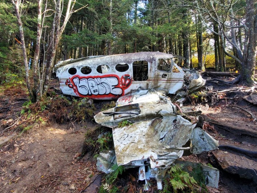
The plane that went down was a CESSNA 414A and even though it could hold eight people, the official accident report said only two people were on board.
Ernest Martin, the pilot, was flying his secretary Centa Jarret from Chicago to Sylva, North Carolina on the night of Nov. 24, 1983. The weather turned against them, with heavy rain and dark clouds swooping in on the aircraft, the report said.
The Federal Aviation Administration said in an attempt to stay on his flight path, Martin tried to fly beneath the thickening cloud cover.
Martin’s attempts failed and the airplane crashed into the side of the mountain, near the Waterrock Knob summit off the Blue Ridge Parkway. The injuries were fatal to both, leaving their bodies frozen in the depths of the mountains until the search team found them a week later.
The FAA also reported additional failures that fell on Martin’s shoulders. He didn’t file the required flight plan and to make matters worse, Martin’s blood-alcohol level was .04%.
It seems he will never live this fateful night down, as many people know that off an unmarked trail near Waterrock Knob, lies the wreckage of the CESSNA 414A.
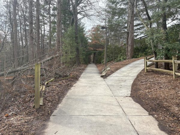
Since the hike to the crash site is an unofficial trail and not well-marked, experienced hikers urge you to not hike alone and to let multiple people know where you are going.
Knowing this, I chose to hike with my favorite hiking buddy, also the man I got to marry in June, Caleb Sonntag. We hopped in our Honda Accord and headed to mile marker 451 off the Blue Ridge Parkway.
Our hike started off at the Waterrock Knob trailhead, located near the visitors center. I knew this hike was going to be about two miles long and not easy. However, I was not prepared for the immediate incline, which never flattened out.
The further up we got, signs warning of part of the trail being washed away led me to proceed with more caution as I gripped the shoulder straps of my Osprey backpack a little tighter. There were two summits, the first being Waterrock and the second, Browning knob.
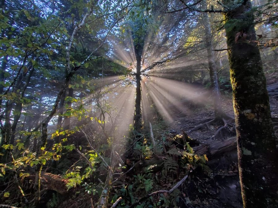
Once past the first summit, fog began to drift in and out of the trees, allowing us glimpses of the surrounding mountains, keeping our curiosity peaked. You can see a wide range of places, including parts of Tennessee, the Cherokee Casino and Ghost Town in Maggie Valley. After ascending a final flight of stone stairs, we made it to Browning Knob.
The cardio workout I just experienced combined with the elevation and cool breeze caused every breath I took to fog up my glasses lenses, impairing my sight. Needless to say, Caleb and I were amazed by the incredible view but our minds were on other things, like finding the unmarked trail to lead us to the wreckage.
“I think it’s that first unmarked trail down by Waterrock summit,” I said.
Caleb started to pace, retracing our steps, trying to figure out what other unmarked trail it could be. He’s a mountain biker so he’s pretty trail savvy and sadly, I trust his opinion over my own.
“No, I think it has to be the one by that rock we just passed on our way up. The trail to the right,” he said.
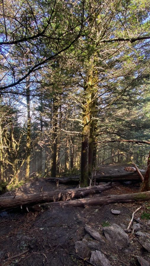
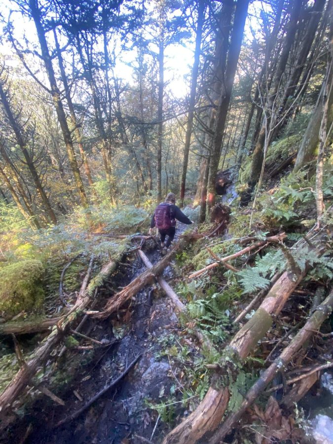
I nodded and followed his lead to what was now an immediate decline. The terrain was rough, full of slippery tree roots and puddles of mud leading us further and further down the side of this mountain. We had entered into what seemed like a whole other world, hidden under a dense cover of forest.
For a while, it was mostly downhill until it became uphill. That’s how this whole trail was, up or down, no in between. At times it became even more difficult with the fog, the dropping temperature, the dampness and plenty of trail obstacles.
After what seemed like forever with no sight of the wreckage, I was convinced we had chosen the wrong trail or gone off the beaten path too far. Caleb was confident though and we eventually discovered little white markers on trees, guiding us along the ridgeline.
It was deathly quiet, with only the faint sound of an airplane flying overhead occasionally. I shivered, from the cool air yes, but also from the spookiness of this place.
“I would never want to be here by myself,” I said, huffing and puffing.
“Imagine being stuck here at night. In the cold. All alone,” Caleb said, sending more shivers down my spine.
We hiked for about an hour until we saw a little trail that looked like it might lead us to a break in the trees where we could hydrate and decide where to go from here. We stepped through the trees into what could have been a painting. My eyes wandered from the tiny parking lot in the far distance, to the summits we had just hiked, the ridgeline I now knew for sure we had been following and to the mountain ranges reaching toward every corner.
The view was breathtaking, one I would argue was better than the two designated summit views. At this point, the sun was shining so brightly and we had hiked so much, I felt warm enough to shed my second layer and soak up that Vitamin D.
Caleb sat down beside me and since surprisingly, we had phone service, he began to use a map and the internet to determine how close to or far from we might be from the crash site.
“I think we literally got onto the Mountains-to-Sea trail,” he said, and I agreed.
“Wait no. From here, it says a short trail will lead you down to the site of the crash,” Caleb said.
It was determined that we would reach a clearing if we hiked a little further up and then down the mountain, we should be able to see the remnants of the crash.
I put my second layer back on, made Caleb humor my recent yoga obsession by taking a photo of me doing the “downward dog” pose and then we continued our search for the crashed CESSNA 414A.
Moments later we reached the clearing, looked down the mountain and there it was. We were both speechless, our feet slipping and sliding as we made our way through the wreckage decorating the side of this mountain.
The plane is now colored with graffiti and people’s signatures, letting the world know they have been here too. Something caught my eyes under the mud and ferns, a sock. Now, that could be from a hiker making a pit stop here or who knows, maybe it’s from Martin or his secretary.
Maybe I believe in ghosts, maybe I don’t but I know one thing for sure, the Waterrock/Browning Knob crash site will give you the spooks and I certainly wouldn’t want to be alone there. Not even for a second.